Live camera
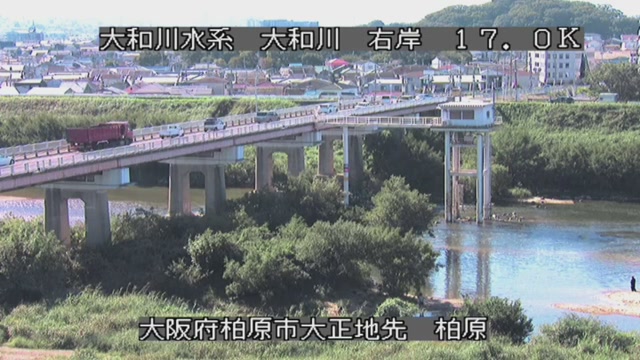
Yamato and Saho Rivers live camera — Nara / Osaka
They gather the Nara basin, cut through the Ikoma hills and reach Osaka Bay. A long stretch runs through built-up areas.
 Sample October 2026
What you are looking at
It gathers all the rain that falls on the Nara basin, crosses the hills at a narrow place called Kamenose, and comes out onto the Osaka plain. Much of its course runs between built-up districts, with inhabited land right up against it. This feed shows points along that stretch in turn.
The thing to watch is the gap between the water and the top of the revetment. Buildings press close to the inside of the embankment, so as the level rises you see the water and the places where people live drawing together inside the frame.
The basin covers 1,070 square kilometres and the channel is 68 kilometres long. The source is the Kasagi hills in Sakurai; the river takes in the Saho at Yamatokoriyama, the Asuka and the Soga at the boundary of Kawanishi and Kawai, and the Tatsuta at Ikaruga, and then heads for Kamenose. Of the Saho, 8.0 kilometres are under direct national management.
The difficulty with this river is Kamenose itself. It is narrow, so water is held back there, the level on the Nara basin side upstream rises sharply, and tributary water that cannot get into the main stem overflows instead. In August 1982, in a flood caused by Typhoon No. 10 and a front, and then by the depression that Typhoon No. 9 became, Kashiwara recorded about 2,500 cubic metres a second, the largest since the war. The embankments of the Nishiyoke and the Kutsuge, both tributaries, were breached, and 21,956 houses were inundated across Osaka and Nara together. Water went over the embankment on the Saho as well.
The level moves at the end of the rainy season and in the typhoon months. When the water is held at Kamenose, the tributaries rise before the main stem does, so the points on the basin side are worth watching too. On a wet day the picture is dark and the drops blur away the detail. Make the evacuation decision on the local authority's information, not on this screen. Points on the main stem and the tributaries are shown in turn.
About this camera
| Place | Nara / Osaka |
| Format | Live video, rotating |
| Time zone | Asia/Tokyo (UTC+9) |
| Category | River |
| Operator | MLIT river live streams |
| Terms of use | Government Standard Terms 2.0 |
The operator's own page
The footage belongs to each agency. This site is an unofficial guide, and each sample frame was copied once per camera under that agency's terms of use.