Live camera
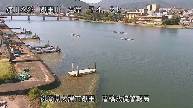
Seta and Yasu Rivers live camera — Shiga
The Seta is the only outlet of Lake Biwa. How much water is let through here sets the level of the lake itself.
 Sample October 2026
What you are looking at
This feed shows two rivers running in opposite directions. The Seta is the mouth by which the water of Lake Biwa becomes a river and leaves; the Yasu is on the side that pours into that lake. The one going out and the one coming in appear in turn in the same feed.
The thing to watch is the difference in how the surface behaves. The discharge of the Seta is set at a weir, so its surface can be quiet even on a day of heavy rain. The Yasu comes straight down off the mountains, so the rain that fell takes shape in it directly.
The Seta has a weir across it. It was placed there in 1905 as part of the Yodo improvement works, to reduce flooding downstream and at the same time — by dredging the bed of the Seta and lowering the lake's ordinary level — to ease flooding around the lake itself. Measured at that weir, the Lake Biwa catchment comes to 3,848 square kilometres. The Amagase dam downstream has a total basin of 4,200 square kilometres, of which only 352 drains directly to the dam.
The Yasu drains 387 square kilometres over a channel 65.25 kilometres long, the largest in Shiga Prefecture. Embankments were raised again and again until the bed sat higher than the land around it, and the written record shows flooding about once every ten years. In the great flood of 1953 the right-bank embankment of the north branch was breached along some 195 metres, and that is what began the work of gathering two separate channels into one.
It moves most at the close of the rainy season and in the typhoon months of August and September. On the same day the Seta, held at its weir, can stay calm while the Yasu clouds over first. The worse the weather, the darker the picture, and drops on the lens break up every edge. Decide to stay or go on the local authority's information. Points on the two rivers appear by turns.
About this camera
| Place | Shiga |
| Format | Live video, rotating |
| Time zone | Asia/Tokyo (UTC+9) |
| Category | River |
| Operator | MLIT river live streams |
| Terms of use | Government Standard Terms 2.0 |
The operator's own page
The footage belongs to each agency. This site is an unofficial guide, and each sample frame was copied once per camera under that agency's terms of use.