Live camera
Kuzuryu and Hino Rivers live camera — Fukui
They carry snowmelt from Mount Haku onto the Fukui plain. Levels rise easily in early spring as the snow goes.
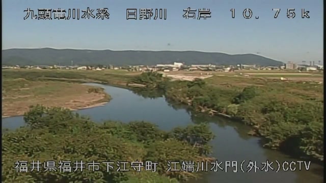 Sample October 2026
What you are looking at
Rising at the Aburazaka pass on the border of Fukui and Gifu, it crosses the Fukui plain and goes out into the Sea of Japan, taking in the Hino on the way. This feed shows points along that stretch in turn.
The thing to watch is the level on a day when no rain is falling. This is snow country, so in early spring snowmelt alone moves the level. There is a season when the river rises because the temperature rose — a logic quite separate from rain.
The basin covers 2,930 square kilometres and the channel is 116 kilometres long; the Aburazaka pass at the source stands 717 metres high. Older documents give 2,934.0 square kilometres and 121.9 kilometres, so it is worth checking the year when comparing figures. The Hino, which joins it, covers 1,275.5 square kilometres over 71.5 kilometres, counting its own tributary the Asuwa.
This river holds an example of a flood arriving after an earthquake. At 4.13 in the afternoon of 28 June 1948 the magnitude 7.1 Fukui earthquake struck directly beneath the Fukui plain; 3,769 people were killed and every bridge over the Kuzuryu was damaged. A month later, from 23 to 25 July, up to 350 millimetres of rain fell, and among the embankments already weakened the left bank gave way at Tomyoji, inundating about 1,900 hectares. In 1959 Typhoon No. 7 flooded 13,096 houses and the Isewan typhoon killed or left missing 34 people and flooded 6,550 more, one after the other; that is what prompted the Kuzuryu comprehensive development scheme and produced the Kuzuryu dam. The Fukui downpour of July 2004 did its damage mainly on the Asuwa, a tributary.
The end of the rainy season in June and July, and typhoons in August and September, move it most, and the level also rises readily during the spring melt. The rougher the day, the darker the picture, and rain on the lens blurs it. Leave evacuation decisions to the information from local authorities. The feed rotates between points.
About this camera
| Place | Fukui |
| Format | Live video, rotating |
| Time zone | Asia/Tokyo (UTC+9) |
| Category | River |
| Operator | MLIT river live streams |
| Terms of use | Government Standard Terms 2.0 |
The operator's own page
The footage belongs to each agency. This site is an unofficial guide, and each sample frame was copied once per camera under that agency's terms of use.
Cameras nearby
- Daimyocho crossingFukui, FukuiLive video
- Near Fukui StationFukui, FukuiLive video
- Owada, FukuiFukui, FukuiLive video
- OnoOno, FukuiLive video
- EchizenEchizen, FukuiLive video
- ObamaObama, FukuiLive video
- Fukui Station EastFukui, FukuiLive video
- Tsuruga Station WestTsuruga, FukuiLive video