Live camera
Kino and Kishi Rivers live camera — Wakayama
Rising at Odaigahara in Nara and reaching the Kii Channel. Orchards line the basin, and the river terraces show up as steps.
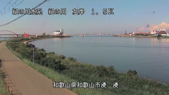 Sample October 2026
What you are looking at
Rising on Odaigahara in Kawakami, Nara, it is called the Yoshino inside Nara Prefecture, changes its name to the Ki on entering Wakayama, and pours into the Kii Channel. This feed shows points along that stretch in turn.
The thing to watch is the difference in height between the two banks. One side rises like a step, and orchards sit on the flat surface above it. When the level rises, the water takes the lower bank first and works up from there.
The basin covers 1,750 square kilometres and the channel is 136 kilometres long; Odaigahara at the source stands 1,695 metres high. Among Japan's class-A rivers that puts it 27th in length and 38th in basin area. Of the river, 62.4 kilometres of the Ki and 6.0 kilometres of the Kishi, which joins it, are under direct national management.
Flood control on this river begins with the Isewan typhoon of September 1959. Along its banks 347 houses were destroyed or badly damaged, 3,180 were flooded above floor level and 1,917 below it, and that is what prompted the plan for the Otaki dam upstream. Preliminary survey began in April 1960, construction in April 1965, the dam body was finished in 2002 and operation started in April 2013. At the dam site the plan assumes 5,400 cubic metres a second arriving, of which 2,700 are held back rather than passed downstream. The dam's own catchment is 258 square kilometres. The Kishi had already suffered heavily in the flood of 1953, after which its course was shortened by cut-off work.
It rises at the close of the rainy season and through the typhoon months of August and September. Otaki dam upstream holds part of it back, so the rain that falls does not pass straight into the level downstream. On a rough day it is dark, and rain on the lens leaves it smeared. Let the local authority's announcements guide the decision to evacuate. Points on the Kinokawa and the Kishigawa are shown in turn.
About this camera
| Place | Wakayama |
| Format | Live video, rotating |
| Time zone | Asia/Tokyo (UTC+9) |
| Category | River |
| Operator | MLIT river live streams |
| Terms of use | Government Standard Terms 2.0 |
The operator's own page
The footage belongs to each agency. This site is an unofficial guide, and each sample frame was copied once per camera under that agency's terms of use.
Cameras nearby
- Kumano and Ainotani RiversWakayama / MieLive video, rotating
- Kushimoto Marine ParkKushimoto, WakayamaStill, hourly