Live camera
Kumano and Ainotani Rivers live camera — Wakayama / Mie
The river the World Heritage Kumano pilgrimage routes cross. Pilgrims once travelled it by boat, and long sections run through gorge.
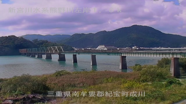 Sample October 2026
What you are looking at
This river runs along the boundary between Wakayama and Mie and goes out into the Kumano Sea. As a river system it is called the Shingu, while the river itself is the Kumano. Much of its course is gorge, and the old pilgrimage road crosses this water. This feed shows points along that stretch in turn.
The thing to watch is the gap between the rock wall and the surface. Both banks stand upright, so rising water does not spread sideways but climbs. How much of the band of rock visible on an ordinary day has gone under tells you how much the river has gained.
The basin covers 2,360 square kilometres and the channel is 183 kilometres long. The Ono, which joins it, is a short river about 10.9 kilometres long, of which 5.7 kilometres are under direct national management. A large main stem and a short tributary: that combination set the shape of what follows.
Typhoon Talas, in September 2011, produced a flood of 24,000 cubic metres a second, exceeding the Isewan typhoon of 1959, until then the largest on record. Water went over the embankment on the Kumano itself, and on the Ono the main river's water came over the gate at the confluence and ran in backwards, inundating almost everything along the banks. The ring embankments built to keep inside water away from the houses — about six kilometres of them across both banks — went under on that occasion, and part of them toppled. Recovery continues as basin-wide flood management for the Shingu system, in the form of channel excavation, embankment strengthening, revetment and ring embankment work.
It moves at the tail of the rainy season and in the typhoon months. When the main stem runs high, water can push from the confluence into the tributary, so the points on the Ainotani are worth watching alongside. On a hard rainy day the picture is dark and drops on the lens smear it. Check with the local authority whether evacuation is called for. Points on the main stem and the Ainotani appear in turn.
About this camera
| Place | Wakayama / Mie |
| Format | Live video, rotating |
| Time zone | Asia/Tokyo (UTC+9) |
| Category | River · World Heritage |
| Operator | MLIT river live streams |
| Terms of use | Government Standard Terms 2.0 |
The operator's own page
The footage belongs to each agency. This site is an unofficial guide, and each sample frame was copied once per camera under that agency's terms of use.
Cameras nearby
- Kushimoto Marine ParkKushimoto, WakayamaStill, hourly
- Kino and Kishi RiversWakayamaLive video, rotating