Live camera
Yura River live camera — Fukuchiyama–Maizuru, Kyoto
From the Fukuchiyama basin down to the Sea of Japan. Long stretches have low levees, so the level is watched closely whenever it rains hard.
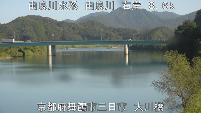 Sample October 2026
What you are looking at
Water gathered in the Fukuchiyama basin runs north through the hills and out into the Sea of Japan. This feed shows points along that stretch in turn. Nearly nine tenths of the basin is mountain, and about a quarter of the area of Kyoto Prefecture drains into this single river.
The thing to watch is the gap between the embankment and the water. Along much of this river the embankment has little height to spare. The sandbars go under first, then the grass of the flood plain, then the embankment itself, so how far the water has come tells you roughly where the level is.
The basin covers 1,880 square kilometres and the channel is 146 kilometres long. Eighty-nine per cent of that basin is mountain; the only flat land is the Fukuchiyama basin and a strip near the mouth. Rain has nowhere else to go but the river, so rain that falls upstream arrives quickly.
In October 2004, Typhoon Tokage pushed the level at Fukuchiyama to 8.30 metres, the highest reading of that year, and at Maizuru National Route 175 went under water and left a tour bus stranded. Afterwards ring embankments were built in eleven districts and house plots were raised in seven, work that finished in 2015. A ring embankment joins one hillside to the next so that the embankment encloses only the settlement. In October 2017 Typhoon Lan brought the level back up to much the same height, and no flooding occurred in the lower reaches.
The water moves at the tail of the rainy season and through the typhoon months of August and September. With so little flat land in the basin, the gap between the first rain and a visible change at the surface is short. While it is raining the picture darkens, and drops on the lens smear it. Decide whether to evacuate on what the local authority announces. The feed works its way around the points in turn.
About this camera
| Place | Fukuchiyama–Maizuru, Kyoto |
| Format | Live video, rotating |
| Time zone | Asia/Tokyo (UTC+9) |
| Category | River |
| Operator | MLIT river live streams |
| Terms of use | Government Standard Terms 2.0 |
The operator's own page
The footage belongs to each agency. This site is an unofficial guide, and each sample frame was copied once per camera under that agency's terms of use.
Cameras nearby
- Katsura RiverArashiyama, KyotoLive video, rotating
- Kizu Riversouthern KyotoLive video, rotating
- Kiyomizu-zaka slopeHigashiyama, KyotoLive video
- Heian Jingu shrineSakyo, KyotoLive video
- Fushimi Inari Taisha, main approachFushimi, KyotoLive video
- Ginkaku-ji, the Silver PavilionSakyo, KyotoLive video
- Eikan-do templeSakyo, KyotoLive video
- Oharano shrineNishikyo, KyotoLive video