Live camera
Ibo and Hayashida Rivers live camera — Himeji, Hyogo
The clear river behind a famous somen noodle-making area. Water quality upstream is good, and on fine days the surface looks genuinely clear.
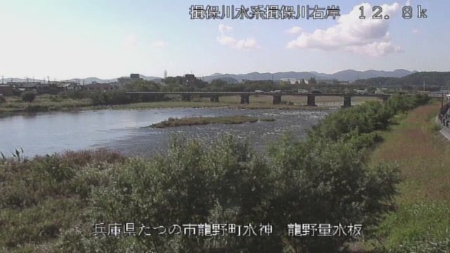 Sample October 2026
What you are looking at
Rising on Mount Fujinashi in Shiso, it takes in the Hikihara, the Isawa, the Sugano and the Kurisu, comes down to the Banshu plain, and goes out into the Harima Sea at Aboshi in Himeji together with the Hayashida. This feed shows points along that stretch in turn.
The thing to watch is the colour of the water. Water quality upstream is good, so on a clear day with no silt even the stones on the bed of a shallow riffle show up in the picture. Conversely, a day when the colour has changed is a day when rain is falling somewhere.
The basin covers 810 square kilometres and the channel is 70 kilometres long, which puts it 74th in length and 76th in basin area among Japan's class-A rivers. The lower basin carries a row of local industries that have depended on this river's water: light soy sauce, hand-stretched somen noodles and Banshu leather. Of the Hayashida, which joins it, 6.6 kilometres are under direct national management.
The flood that stands in this river's record is the one of September 1976, when Typhoon No. 17 and the autumn rain front came together. From the 9th to the 11th, places across the basin took around 150 millimetres a day one after another and the total reached 600 millimetres. The reference gauge at Tatsuno recorded a peak of 2,031 cubic metres a second, yet the main stem neither overflowed nor broke. The damage concentrated on the tributaries: the Kurisu suffered a breached embankment, overflow and lost bridges, and on the Hayashida the Irino bridge was washed away. Houses flooded came to 3,034 and the area inundated to 2,782 hectares. This flood and the one of August 1970 are what prompted the flood-control plan to be revised.
It moves most at the end of the rainy season and in the typhoon months of August and September. The main stem can hold while trouble happens on a tributary, so on a day the water changes colour the points on the Hayashida are worth a look. In rain the picture is dark and the drops take the image apart. Confirm with the local authority whether danger is closing in. Points on the main stem and the Hayashida come up in turn.
About this camera
| Place | Himeji, Hyogo |
| Format | Live video, rotating |
| Time zone | Asia/Tokyo (UTC+9) |
| Category | River |
| Operator | MLIT river live streams |
| Terms of use | Government Standard Terms 2.0 |
The operator's own page
The footage belongs to each agency. This site is an unofficial guide, and each sample frame was copied once per camera under that agency's terms of use.
Cameras nearby
- Higashi-Harima coastAkashi–Kakogawa, HyogoLive video, rotating
- Maruyama and Izushi RiversToyooka, HyogoLive video, rotating
- Kako and Manganji RiversKakogawa, HyogoLive video, rotating
- Ina and Mo RiversHyogo / OsakaLive video, rotating