Live camera
Kako and Manganji Rivers live camera — Kakogawa, Hyogo
Running straight south across the Harima plain to the Seto Inland Sea. The mouth sits next to an industrial belt.
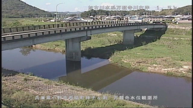 Sample October 2026
What you are looking at
This river runs north to south through roughly the middle of Hyogo Prefecture and out into the Harima Sea. An industrial belt spreads out near the mouth, and river and factory sit side by side. This feed shows points along that stretch in turn.
The thing to watch is the width of the lower reaches and the use made of the flood plain. Because the river crosses a plain, the flood plain is laid out broad, and that ground serves as grassland and sports fields. When the water rises, that ground in use is the first thing to go under.
The basin covers 1,730 square kilometres and the main channel is 96 kilometres long. Within Hyogo it carries a larger catchment than the Maruyama, at about 1,300 square kilometres, or the Ibo, at 810. The Mangan, which joins it, is the main tributary of the middle reaches at about 145 square kilometres.
The flood of September 1976 came from Typhoon No. 17 and the autumn rain front. Rainfall reached 191.4 millimetres, the gauge at Kunikane recorded 2,800 cubic metres a second, and the damage came to 143 houses flooded above floor level, 1,657 below it, 5,923 hectares inundated and one death. In sheer discharge, though, September 1983 was larger at 4,900 cubic metres a second. Even on one river, the order of the damage and the order of the discharge do not match.
Things stir at the end of the rainy season and in the typhoon months of August and September. How far the wide floodplain has gone under serves as a gauge, though the size of the flow and the size of the damage do not always rank the same. In bad weather the picture darkens and rain on the lens smears it. Check with the local authority whether evacuation is needed. Several points are shown here one after another.
About this camera
| Place | Kakogawa, Hyogo |
| Format | Live video, rotating |
| Time zone | Asia/Tokyo (UTC+9) |
| Category | River |
| Operator | MLIT river live streams |
| Terms of use | Government Standard Terms 2.0 |
The operator's own page
The footage belongs to each agency. This site is an unofficial guide, and each sample frame was copied once per camera under that agency's terms of use.
Cameras nearby
- Ibo and Hayashida RiversHimeji, HyogoLive video, rotating
- Higashi-Harima coastAkashi–Kakogawa, HyogoLive video, rotating
- Maruyama and Izushi RiversToyooka, HyogoLive video, rotating
- Ina and Mo RiversHyogo / OsakaLive video, rotating